
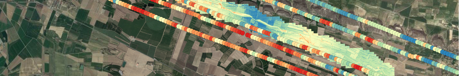
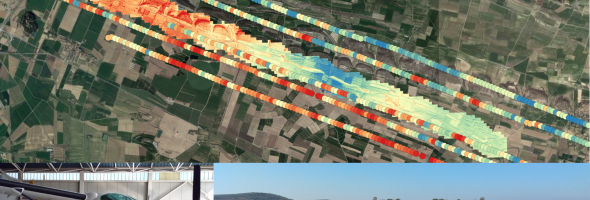

First airborne optical and GNSS-R campaign conducted in the framework of the HUMIT project to test the readiness of the data fusion technique. Two separated regions of interest (ROIs) were defined: the surroundings of Balaguer and Tremp. The plane carried 4 different instruments: a hyperspectral sensor (AisaEAGLE-II), a thermal sensor (TASI), a reflectometer (CORTO), and a radiometer (ARIEL, Balamis). The main scope of the experiment was to acquire optical data with the AISA and the TASI instruments to perform a data fusion with the soil moisture data retrieved from the CORTO. The L-band radiometer will be used, later on, to perform an instrumental performance inter-comparison once all data has been processed.